Great Southern water source and desalination

What are we doing?
Preferred location identified
To help secure Albany’s future water supply, Nanarup has been selected as the preferred area for a small‑scale desalination plant. It scored more favourably across technical, environmental and operational criteria and offers safer construction conditions and favourable ocean conditions for brine dispersion.
We thank the community for their input. A summary of the multi‑criteria assessment, community feedback and the webinar presenting the key points discussed at the Nanarup community session on 2 February 2026 is available.
Further studies are now underway, including geotechnical, environmental, Aboriginal heritage, land and marine investigations.
 Conceptual visual showing what a 3 GL seawater desalination plant at Nanarup could look like.
Delivering a climate-resilient, sustainable drinking water source
We’ve looked at different ways to increase supply. Alternative sources like accessing additional groundwater and recycling water for drinking can't close the gap between increasing demand needs and supply. Groundwater will continue to play a part of our water future, but it won’t be enough on its own. See our FAQs to learn why groundwater and recycled water for drinking isn’t the preferred option.
Based on current projections, annual demand in the region will exceed supply by 2030, with an additional 1,800 million litres of drinking water per year needed by 2050. To ensure we can meet the region’s water needs beyond 2030, we are planning for a future seawater desalination plant near Albany. Learn more about why we need a new water source.
Minimising environmental impact
Environmental monitoring and data collection starts before a site is selected for any seawater desalination plant. This information helps us design and position the infrastructure to minimise environmental impact. It also forms part of the environmental impact assessment and approval application that is sent to the Regulator.
We're undertaking flora and fauna surveys across the investigation area. These surveys will help us understand the environmental values associated with conservation significant flora and fauna species that need to be considered in our infrastructure planning.
Learn how desalination plants are carefully planned to meet strict environmental standards and ensure minimal impact on the nearby marine environment.
Project timeline
- Public engagement on next source
- 2021 - 2025
- Initial site investigations (engineering, marine & environmental)
- 2025
- Decision on next source location
- Early-2026
- Detailed site investigations in preferred area (engineering, marine & environmental)
- 2026
- Public engagement on site and pipeline route
- 2026 - 2028
- Concept design of infrastructure
- 2026 - 2027
- Environmental approvals
- 2026 - 2028
- Design and construction of next source
- 2028 - 2030
- New source required for the Lower Great Southern
- 2030
What happens next?
The Albany community will continue to play an important role in shaping this project. Your feedback helps us ensure we deliver a solution that supports the region for decades to come. We’ll share details about future engagement opportunities with you soon. The proposal remains subject to upcoming federal and state regulatory and environmental approvals.
A proposed seawater desalination plant is planned to help secure a long-term water supply for the Great Southern.
We’re seeking ideas on how to give back to Albany through legacy initiatives that deliver meaningful community benefits for years to come. These could:
- restore and enhance natural environments and habitats
- support social, education or community projects
- provide funds or resources to local organisations
- protect or celebrate cultural and historical values
Share your ideas at one of our in-person workshops on Tuesday 9 June 2026 at Lower Kalgan Hall, 516 Nanarup Road.
1. Afternoon session: 12:30pm to 2:30pm (Session full)
2. Evening session: 5:15pm to 7:15pm
Please note that registrations are now closed.
Can't attend but wish to get involved? We'll share future opportunities via email.
Water Corporation will soon be completing geotechnical investigations in the Nanarup area, including at Nanarup Beach, west of Taylor Inlet in the City of Albany.
This work is part of ongoing investigations into the design and location of pipelines that may connect to a proposed seawater desalination plant located further inland.
This work will be completed by Water Corporation’s authorised contractors, FSG Geotechnics Foundations. The work is scheduled to begin on Monday 25 May 2026 and is expected to take up to seven days to complete, subject to weather conditions. Activities will take place between 6:30am and 5:30pm.
What does this work involve?
The investigations will help us better understand underground conditions and support future planning. Activities include:
- Non-invasive geophysical testing along set survey lines to help understand underground conditions and how deep solid rock (bedrock) lies below the surface.
- Cone penetration testing (CPT) at a small number of locations to assess subsurface layers and ground strength.
Geophysical testing involves placing small sensors on the ground surface and using a handheld sledgehammer to generate low-energy seismic waves. These vibrations are brief and controlled to minimise disturbance.
Cone penetration testing will be carried out using a small, tracked testing vehicle. This method involves hydraulically pushing narrow, instrumented rods into the ground to depths of around 40 metres. It does not involve drilling, excavation, or the removal of soil or rock. Once testing is complete, the rods are removed, and the surface is left stable and undisturbed.
The beach and car park will remain open during the investigation period. For safety, small, controlled work areas will be established around active testing locations. We ask that beach users follow any signage and directions from on-site staff.
Water Corporation will soon complete an environmental investigation in waters off Nanarup Beach, within the City of Albany. This work is part of studies to understand the features of the ocean floor and the existing marine life in the area.
Information gathered will support careful planning for a proposed seawater desalination plant. The plant, which is planned to be located further inland, will provide essential water supply to the Lower Great Southern region. The plant, which is planned to be located further inland, will provide essential water supply to the Lower Great Southern region.
Our authorised contractor, O2 Marine, is expected to complete this work between Tuesday 7 April and Thursday 9 April 2026 subject to weather conditions.
What to expect:
- The investigation will involve a small vessel operating offshore, towing a sonar and a scanner. Together, this equipment uses sound waves and images to create a detailed picture of the ocean floor and map existing plant and marine life, such as seagrass and coral.
- We do not expect this activity to have any impact on beach visitors or access.
We are currently completing a geotechnical investigation in a small area of Nanarup Beach, west of Taylor Inlet in the City of Albany. This work is part of required studies for potential pipelines that will connect to a seawater desalination plant. The plant, which is planned to be located further inland, will provide essential water supply to the Lower Great Southern region.
Our authorised contractor, FSG Geotechnics & Foundation, arrived on Sunday 22 March to prepare, and work began on Monday 23 March. This work was initially expected to take about five days to complete. It is now expected to take up to seven days to complete.
What to expect:
- Work will take place between 6:30am and 5:30pm.
- The work involves drilling a small borehole up to 40 meters deep to collect rock samples, helping us to understand ground conditions and rock strength.
- You may notice machinery such as a mounted drill rig, support truck and light vehicles. The support truck will be parked in the Nanarup car park when not in use.
- The Nanarup car park and beach will be accessible during this work, with an exclusion zone set up around the drilling area on the beach to ensure safety.
Click here for more information.
During this session, we shared the results our our multi‑criteria assessment, and that Nanarup has been selected as the most favourable location for a proposed small-scale desalination plant. A webinar presenting a summary of the multi-criteria assessment is available.
If you’d like to see the topics of discussion, you can review the record of questions asked at the meeting here.
Join us at the Lower Kalgan Hall to hear an update on future water source planning for Albany.
- Location: Lower Kalgan Hall, 516 Nanarup Rd, Kalgan WA 6330
- Date: Monday, 2 February 2026
- Time: 5:30pm – 7:00pm
We look forward to seeing you there and hearing your thoughts.
The session will be held in person, and a recording will be shared on the project page in the days following the meeting to ensure anyone who is unable to attend can still access the information.
Update on community meeting - Dec 2025
Join us at the Lower Kalgan Hall to hear an update on future water source planning for Albany.
- Location: Lower Kalgan Hall, 516 Nanarup Rd, Kalgan WA 6330
- Date: Monday, 2 February 2026
- Time: 5:30pm – 7:00pm
We look forward to seeing you there and hearing your thoughts.
The session will be held in person, and a recording will be shared on the project page in the days following the meeting to ensure anyone who is unable to attend can still access the information.
Update on latest community meetings - Nov 2025
We recently hosted two community meetings at Lower Kalgan Hall to connect with locals and answer questions about the project and the two areas under investigation; Sandpatch and Nanarup. During these sessions, we shared information on the planning and site selection process, how seawater desalination works, and the ways we incorporate environmental considerations into our planning.
These conversations are invaluable - they help us understand what matters most to the community and provide clarity on areas of interest.
If you’d like to see the topics of discussion, check out the record of questions asked at the meeting below. We’ll be back at Lower Kalgan Hall on Wednesday, 10 December for another session, and we hope to see you there.
- Lower Great Southern source planning - Lower Kalgan Hall meeting record October 2025
- Lower Great Southern source planning - Lower Kalgan Hall meeting record November 2025
Investigation activities completed - Nov 2025
Since announcing two new areas for investigation: Nanarup and South Coast - Sandpatch, we have completed the following activities:
- Shore Crossing & Marine Works Concept Study
- South Coast Intake Bores Study
- Zero Liquid Discharge Study
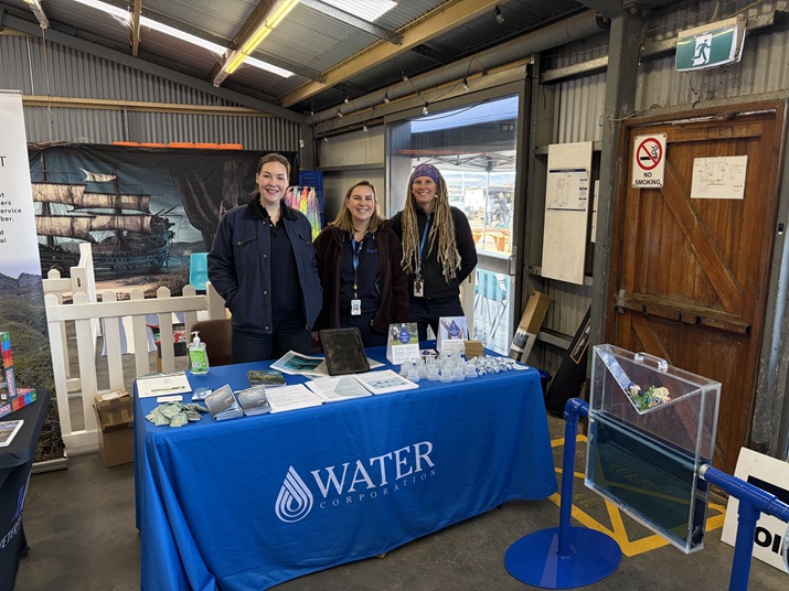
Community drop ins - Sep & Oct 2025
 Over the past few weeks, the project team has been out and about across Albany meeting with community members and answering questions about the Lower Great Southern's next water source.
On Tuesday, 30 September, we were pleased to be part of the Museum of the Great Southern's school holiday program, where we had some great conversations with locals and visitors alike. Then, on Monday, 6 October, we set up at Albany's Historic Whaling Station, speaking with attendees and sharing insights into the project’s goals and progress.
Next, we’re excited to be attending the inaugural Albany Harbours Sustainability Symposium at Great Southern Grammar School on Friday, 31 October. This event will bring together a range of local organisations to share insights into key sustainable development projects taking place across the Great Southern region.
We look forward to seeing you there - come say hello!
Community drop in - Aug 2025
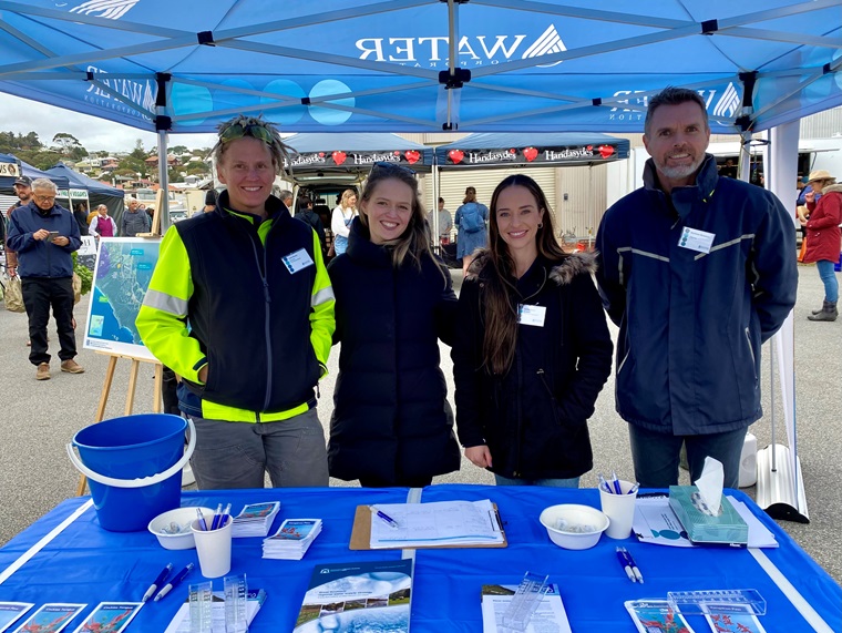
Thanks to everyone who came to see us at the Albany Farmers Market on Saturday, 9 August.
We had some great conversations about future water source planning and chatted with around 40 people. Keep an eye on our webpage for more opportunities to connect!
July Community drop in opportunity - July 2025
Thank you to those who visited us on Saturday, 5 July at All at Sea Saturday to discuss future water source planning with our team.
We had nearly 90 conversations across the day. Stay tuned to our webpage for upcoming opportunities to connect and share your thoughts!

Potential desalination locations shared - July 2025
As part of our water supply planning, we are now investigating new areas for a potential future seawater desalination plant near Albany.
The areas are:
- Nanarup
- South Coast - Sandpatch
A new water source is expected to be required for the Lower Great Southern drinking water supply by 2030.
Please see a map showing the new areas of investigation below.

What did you do to arrive at these options?
We completed an initial desktop assessment, which found these two areas to be the most promising for further investigation.
This assessment considers what we currently know about environmental, social, technical, economic, operations and construction related factors as well as regulatory and approval requirements.
It is not a comprehensive assessment and is only an initial step in determining the most suitable area for further detailed investigations.
Community and stakeholder engagement will be a key part of the next steps.
We also acknowledge that there may not be a perfect solution. Finding a location to satisfy community, environmental, constructability and operating constraints will be challenging.
Why are these areas looking favourable?
Distance from Albany
The two areas are located close to Albany. Early investigations indicate we should be able to connect into the current water supply network at both locations. The Nanarup area is near the large water main pipeline from the existing Two People’s Bay Water Treatment Plant. The South Coast – Sandpatch area is near the South Coast Water Treatment Plant.
Seawater desalination plants (like most water sources) need long and large water pipelines to carry the water to where it is needed.
We look to find efficient routes for pipelines and install them in areas already clear of vegetation, where possible. However, long and large pipelines usually involve some vegetation clearing and can also impact private landowners.
That’s why it’s usually better to have seawater desalination plants closer to where the water is needed - to help reduce environmental and social impacts.
Environmental considerations
New water infrastructure must ensure the unique and important environmental value of the South Coast region is protected. Wherever possible, we avoid installing new water infrastructure in sensitive areas, such as National Parks and Nature Reserves. Large areas of Albany’s coastline are protected by National Parks and Nature Reserves, and with King George Sound ruled out for seawater desalination infrastructure, limited areas are available.
What other areas have you considered?
We’ve been looking at potential seawater desalination infrastructure sites since an initial study was completed in 2009. We’ve reviewed a large area, spanning from Walpole to 50km east of Albany. In late 2022 we began community and stakeholder engagement, and some investigation activities at three potential seawater desalination infrastructure sites: Princess Royal Harbour, South Coast – Torndirrup and Frenchman Bay. Through this process we also explored Vancouver Peninsula and Salmon Holes.
Princess Royal Harbour was ruled out in late 2024 due to water quality concerns identified through monitoring, and the presence of significant Aboriginal cultural values highlighted during engagement with Traditional Owners. We also ruled out progressing Vancouver Peninsula and Salmon Holes due to significant Aboriginal cultural heritage values.
Investigations at the South Coast – Torndirrup site were discontinued due to safety and logistical challenges. Sea conditions and shifting ocean sediments made continued environmental monitoring unsafe. High cliffs would pose issues for the installation, commissioning, operation and maintenance of marine infrastructure.
Hydrodynamic modelling of the marine environment in Frenchman Bay had commenced, however desalination options in King George Sound were ruled out in January 2025 due to community concern and this work was discontinued.
We’ve re-assessed our options and identified two alternative areas for investigation.
What happens next?
We're still in the early stages of investigating these areas. We want your feedback to help shape our next steps. That’s why, over the coming months, we’ll be inviting you to share your thoughts on the two areas. We want to understand what matters most to you as we plan new water infrastructure.
Visit us in-person this Saturday 5 July at All at Sea, at the Albany Boatshed.
Our team will be there to listen and answer any questions you have.
Or reach out to the team at Community.Engagement@watercorporation.com.au to share feedback or ask a question.
Project investigations update - Jan 2025
Following recent announcements, we are no longer progressing investigations into a potential desalination plant at King George Sound in Albany.
We are still in the planning phase of the project and will continue investigating seawater desalination and groundwater options. We will provide further updates in coming weeks.
Project update - 27 April 2024
Conversations at the Albany Port Open Day
The project team attended the Albany Port Open Day on the 27th of April 2024 to share the latest on our new water source investigations with the local community.
It was great to take part in such a well-run event. Seeing the scale of the operations and learning about the inner workings of the port was fascinating!
We spoke to over 100 local community members on the day and had really valuable conversations, not only about our investigations, but also about our existing water source and the challenges we're facing with the effects of climate change and forecast increases in demand.
Thanks to everyone who came down and we look forward to seeing you again when we are next in Albany.

Project update - 15 February 2024
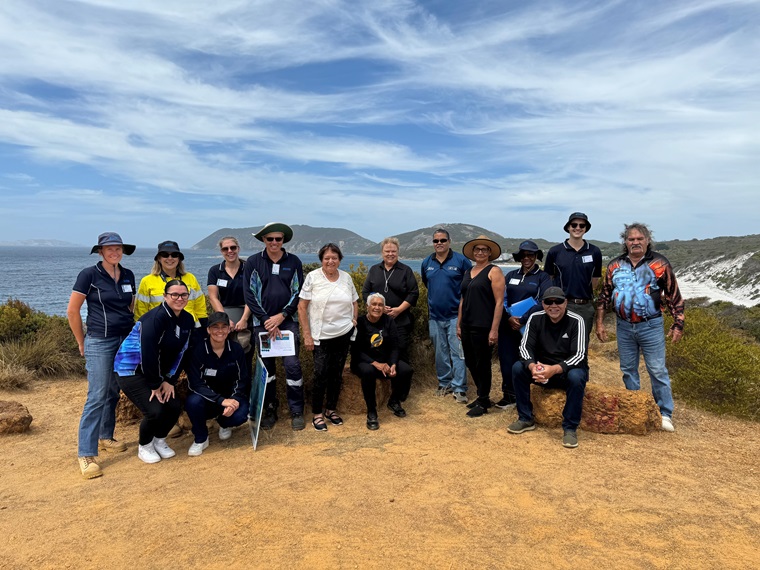
Site tour with Wagyl Kaip Southern Noongar Aboriginal Corporation Cultural Advisory Committee
In mid-February 2024, the project team took six members of the Wagyl Kaip Southern Noongar Aboriginal Corporation Cultural Advisory Committee on a half-day tour of the proposed desalination sites.
The purpose of the tour was for the project team to understand the cultural values of the proposed desalination sites and incorporate any feedback from Wagyl Kaip SNAC CAC into our decision making.
We will now progress with further surveys to support our ongoing investigations.
Project update - 23 June 2023
Marine investigations begin
Water Corporation’s authorised consultants, Advisian, and a commercial boat operator will begin investigations in Frenchman Bay, Princess Royal Harbour and off the South Coast in late June 2023.
The work will take three days. Exact work dates will depend on weather conditions and availability of contractors and their vessels. Further sampling and data collection will take place on a quarterly basis for up to 24 months.
Project update - 27 May 2023
Community drop-in sessions
The project team hosted two drop-in sessions in Albany on Friday, 26 May and Saturday, 27 May 2023.
We had many interesting conversations and received useful feedback that will help inform our investigation pathway. Thank you to those who joined us to learn more about our new water source investigations.
We are now progressing with further planning for the investigations, and will keep the community updated as we progress. Sign up for updates via the link on the webpage to hear the latest project news.
Project update - 29 July 2022
Aboriginal Heritage surveys complete
We’re pleased to advise fieldwork for our Aboriginal Heritage survey in the Manypeaks, Two Peoples Bay, Big Grove, Little Grove and Goode Beach areas has now been completed. This work is part of an investigation into groundwater and seawater desalination as future water source options in the areas.
Thank you to those landowners for facilitating access to private properties.
Project update - 16 December 2021
Environmental surveys complete
We’re pleased to advise fieldwork for our environmental survey in the Manypeaks, Two Peoples Bay, Torndirrup, Big Grove, Little Grove and Goode Beach areas has now been completed. This work is part of an investigation into groundwater and seawater desalination as future water source options in the areas.
Thank you to those landowners for facilitating access to private properties. The survey area was large – extending much further than the actual area required for any infrastructure – to ensure we could capture accurate environmental data and to put any results into context. The consultants will now take the next few months to sort and analyse all the data collected, and prepare findings.
Next, we are preparing to undertake Aboriginal heritage surveys in the same areas with Traditional Owners, in the new year. We will write to affected landowners regarding this.
Happy holidays!
Environmental impact and brine FAQs
Visit our desalination page to learn how seawater desalination works and the steps we take to minimise the impact of desalination plants on land and marine environments.
The proposed Albany Seawater Desalination Plant
The proposed plant is considered small in scale, and is being planned with careful consideration of the surrounding natural environment. For context, the Southern and Perth Seawater Desalination Plants are significantly larger, with capacities of 100 GL and 50 GL per year respectively. This compares to the proposed Nanarup desalination plant, which is considered a much smaller-scale facility with an initial capacity of approximately 3 GL per year.
The Albany plant needs a 3-4 hectare site, with 0.7ha consisting of a building similar size to Orana shopping centre. The Plant will ideally be located inland from the dunes and across from the marine pipelines for seawater intake and brine discharge.
A desalination plant typically consists of:
- Intake pumps and strainers for initial seawater collection
- Buildings with pre-treatment systems to remove impurities before desalination
- Reverse osmosis membranes for the core desalination process
- Potabilisation equipment to make the water suitable for consumption
- Dosing facilities for membrane cleaning and process control
- Various tanks and pumps to support water storage and distribution
In addition to the marine pipelines, an integration pipeline will be required to transfer the drinking water from the plant to the Albany Regional Water Scheme.
A future plant in the Albany area will be relatively small and visually more discreet with an expected initial 3 GL (billion litre) capacity, subject to further design and modelling, vs 100GL at WA’s largest desalination plant.
Desalination can be scaled up relatively efficiently when future capacity is considered early in planning and design. The initial capacity of 3 GL per year is currently anticipated to meet projected population needs through to around 2050. Current design considerations, planning and approvals are being undertaken with a view to a potential expansion to an ultimate capacity of around 6 GL per year in the longer term.
There will be no permanent change to beach access, with only temporary impacts during construction.
We have heard clearly from the community that visual amenity is very important. There will be no permanent visible pipes or pumps located on any of the beaches. All pipelines are expected to be underground, so they would not affect swimming, surfing, or access to the beach.
The proposed seawater desalination plant at Nanarup will be regulated under the prescribed standards for noise emissions set by WA’s Environmental Protection (Noise) Regulations 1997 (the Regulations). Compliance with the Regulations will be monitored by the Department of Water and Environmental Regulation.
The Regulations set assigned noise levels, which is the maximum allowable noise levels for different premises (at the location of the receiver) and are designed to protect sensitive premises (e.g. homes) from noise. This means the proposed plant must be designed and operated to ensure noise emissions remain within the relevant assigned noise levels.
As part of the design and approvals process, we will undertake a detailed noise emission assessment in the Nanarup area to understand baseline noise, potential noise emissions and apply mitigation measures where appropriate to meet the Regulations.
Under the Regulations:
- 45 dB (day), 40 dB (evenings and day time Sundays and Public Holidays) and 35 dB (night) are the assigned levels for noise sensitive premises such as residential.
- Must be met 90% the time.
30 dB is the equivalent to whispering and 40 dB is quiet radio music.
Light from both construction and ongoing operations will also be carefully managed. The project will comply with the Environmental Protection Act 1986 and follow, as far as practicable, the National Light Pollution Guidelines for Wildlife. This includes assessing potential effects on local wildlife, vegetation and nearby residents, and designing lighting to minimise impacts.
As we are still in the early stages of design, we do not yet have site‑specific noise or lighting information. We will continue to share updates with the community as more detailed studies and design work are completed.
Water Corporation is committed to cutting carbon emissions and aims to reach net zero by 2035. We're already making strong progress, with advanced plans to secure new renewable energy sources like wind power to help achieve this goal. The same amount of power needed to operate our seawater desalination plants will be fed back into the grid in the form of renewable energy.
What are the environmental considerations?
We begin the environmental impact assessment (EIA) and approval process after we complete our planning, investigations and concept design. The potential environmental impacts of desalination proposals are defined, assessed, managed, and monitored under the Environmental Protection Authority’s (EPA’s) Environmental Quality Management Framework (EQMF) for the State’s marine waters. The EQMF is set out in the EPA’s (2016) Technical Guidance: Protecting the Quality of Western Australia’s Marine Environment.
The process includes referring the proposal to the EPA under Part IV of the Environmental Protection Act 1986. EIA is a step-by-step way to assess how a proposal might impact the environment. A key step in EIA is finding effective controls and management measures. This helps reduce possible negative environmental impacts. The referral must show we're using the best measures. It must also show we have genuinely evaluated the location and design options for the proposal. This, along with the proposed environmental management measures, will ensure the EPA’s environmental objectives are met. The EPA also has a publicly available consultation hub.
At this stage, it is anticipated that a referral to the Environmental Protection Authority may occur in 2028. This timeframe remains indicative and is subject to change, depending on project progression and the completion of further investigations and studies.
We carry out detailed marine studies, including assessments of whales and other marine mammals, as part of the environmental impact assessment. These findings guide our State and Commonwealth approvals and shape our Marine Environmental Management Plan. Our risk mitigation strategies might include planning marine works to avoid key migration periods, the use of marine mammal observers during marine works and using equipment that keeps underwater noise below levels known to affect whales and other large marine fauna. We’ve sought advice from both UWA and Little White Whale Project on whale numbers and will continue to work with the experts as we move forward.
Environmental monitoring and data collection takes place as part of planning for any seawater desalination plant. This information helps us design and position the infrastructure to minimise environmental impacts. It also forms part of the environmental impact assessment and approval application that is sent to the Regulator.
Monitoring of the marine environment includes:
- water quality monitoring of the ocean including existing contaminants, salinity, temperature and dissolved oxygen levels (up to two years)
- benthic habitat mapping, which is the process of identifying and mapping underwater environments, specifically the seafloor and the organisms that live there. This includes mapping of reefs, troughs and freshwater seeps
- targeted surveys of marine flora and fauna, where required.
In addition to monitoring, we also complete the following studies:
- desktop review of existing historical data and literature
- ecotoxicity testing in a laboratory, which tests whether the brine could have an impact on the critical life stages of local marine species
- we engage with Traditional Owners and other community and industry stakeholders to identify their key uses, and values and concerns.
In seawater desalination plants, brine is the salty byproduct returned to the ocean. It is nearly twice as salty as seawater because about 35-45% of the freshwater is removed, depending on the design of the desalination plant. Brine may contain very small amounts of food-grade chemicals like anti-scalants and cleaning agents, used in the desalination process. They are used to keep the membranes working efficiently. Only chemicals approved by the Department of Health for use in drinking water are used, and this is considered in the environmental impact assessment.
Brine is returned to the ocean through a brine pipeline with a diffuser at the end. Diffusers help rapidly mix and dilute the brine with seawater so that salinity reduces to match the surrounding seawater, generally within tens of metres. Mixing and dilution minimises the impact on marine life and ecosystems. Brine continues to mix with seawater after it leaves the diffuser. It will not form pools of hypersaline water or collect in depressions or basins.
Whenever we can, we try to avoid sensitive marine habitats, such as seagrass. We prefer to install brine diffusers in areas with bare sand. We complete 3D brine dispersion modelling using data on local waves, tides and currents. This helps us understand how brine disperses into the ocean after discharge. This also helps us design the brine diffusers specifically for the location where they will be installed, so that we ensure the brine is being effectively dispersed into the surrounding ocean.
Mobile marine life that prefers lower salinity will move away from the brine. However, many species that tolerate high salinity will remain near the diffuser. Our diffusers at the Southern and Perth Seawater Desalination Plants show that they create habitats for marine life. Fish, mussels, starfish and seahorses often gather around these structures and grow on them, creating unique ecosystems.
While the brine released from a desalination plant is saltier than seawater at the point of discharge, it does not make the ocean as a whole saltier. The ocean is part of a natural, constantly moving system known as the water cycle. Water is continually evaporating from the ocean's surface (leaving the salt behind), forming clouds, and returning as rainfall, much of which flows back to the ocean via rivers. This process naturally maintains the ocean's overall salinity over time. In addition, the ocean is extremely large and dynamic, with waves, tides and currents constantly mixing and redistributing salts. The brine is rapidly diluted and dispersed, so beyond the immediate area of the outlet, salinity returns to normal background levels and becomes indistinguishable from the surrounding seawater.
You can also see the New Water Source Lower Great Southern Region - Brine Dispersion Modelling Webinar which provides detailed information on brine dispersion, specifically in relation to the proposed desalination plant at Nanarup.
There is also a helpful video on our website that explains the desalination process and includes underwater footage from an existing plant.
Marine life on the diffuser of an outfall pipeline
We completed a study in Albany to investigate the option of brine recycling, known as zero liquid discharge - for managing brine rather than returning it back to ocean.
The infrastructure required, such as evaporation ponds or advanced treatment technologies, would be extremely costly and energy intensive. For example, evaporation ponds would need hundreds of hectares of land and cost hundreds of millions of dollars, likely requiring clearing or repurposing of agricultural land. Alternative methods like evaporators and crystallisers also have high energy demands and operating costs.
The salt produced is not suitable for food-grade use, and there no known industrial demand in Albany for low-grade salt, meaning it would need to be sent to landfill.
For all these reasons, brine recycling is not a practical, environmentally sound or cost-effective solution. Based on our experience operating desalination plants, we are confident that ocean discharge can be managed in a way that is safe for the environment and acceptable to the community.
You can see a summary of the Zero Liquid Discharge Study or in the library tab.
What to expect and how you can be involved
The Albany Community Consultation Group (CCG) provides a forum for community members and Water Corporation to discuss the proposal to build a seawater desalination plant at Nanarup.
The CCG doesn't make decisions; it is a forum for sharing information, insights and feedback. The group will help ensure that community values, interests and concerns are understood and considered alongside technical, environmental and regulatory requirements.
The CCG was established in 2025, when members were consulted on potential locations for a seawater desalination plant (SDP) in Albany. The group met every six weeks from July 2025 until February 2026.
New members have now joined the CCG, with meetings held quarterly during 2026 and continuing until June 2027. With Nanarup selected as the preferred location, the group plays an important role in providing local perspectives during the planning and design phase.
Further information is available in the Albany CCG Terms of Reference and Code of Conduct. You can additionally find the CCG Meeting Minutes in the library tab.
The current community members participating in the Community Consultation Group are listed below:
- Chris Meuzelaar
- Derek Van Buren
- Diane Evers
- Frank Ruggera
- Gary Crockford
- Laura Bird
- Sandra Swain
- Sarah-Louise Collins
- Olivia Roberts
- Amie Montefiore
- Chris Gunby
- Janet Curlewis
- Robert Michael
- Simone De Giambattista
- Wayne Monks
- John Collis
- Georgina Mullens
- Grant Regan
- Peter Gilmour
2026 meeting schedule:
- Monday 2 February, completed
- Tuesday 19 May
- Tuesday 15 September
- Tuesday 1 December
Community feedback plays an important role in informing the planning process by helping us understand local values, concerns, priorities and aspirations for both the project and the region more broadly. Feedback received through community engagement activities, including information stalls, stakeholder meetings, face to face meetings with landowners, community surveys, Community Consultation Group discussions and individual enquiries, is carefully considered throughout project planning alongside technical, environmental, cultural heritage and regulatory considerations.
Throughout the project, we have received feedback on a wide range of issues, including construction impacts, operational noise, visual amenity, marine management, recreation, energy requirements, water aesthetics, community legacy benefits, employment opportunities and opportunities for future water services. This input helps us better understand community priorities and identify matters that require further investigation, consideration or management.
Community feedback is one of several factors considered in project decision making. It forms part of the social assessment undertaken as part of our broader evaluation process, alongside environmental, technical, operational, economic and regulatory considerations. While community feedback does not determine project decisions on its own, it is a key input that helps shape project planning, assesses potential impacts and informs measures to avoid, minimise or manage those impacts.
As planning for the preferred Nanarup site progresses, community and stakeholder feedback will continue to help support our planning and design. Social impacts and community feedback will also be considered as part of the project's formal environmental assessment and approvals processes.
We remain committed to providing timely information and opportunities for community input as the project progresses. Engagement activities will continue to include information stalls at local community events, stakeholder and community group briefings, face to face meetings, Community Consultation Group meetings, email updates and regular updates through the project webpage, ensuring the community remains informed and can provide feedback throughout the planning process.
Community engagement for a new water source for Albany has been ongoing since 2022. Our initial customer research gathered key insights from Albany residents to inform our planning. It included six focus groups and 450 surveys. Early stakeholder engagement began in 2022-23 with project information sheets issued to over 50 community, industry and stakeholder groups and over 20 in-person meetings.
Following the Minister’s announcement in May 2023 regarding a new source being required, engagement expanded to the broader community through public information sessions in Albany and regular project updates via email. As investigations progressed, engagement continued with in-person meetings with landowners on groundwater options, a site visit with the Traditional Owners from Wagyl Kaip Southern Noongar Aboriginal Corporation’s Cultural Advice Committee, and further stakeholder briefings with City of Albany and Councillors, community and industry groups.
Feedback received during engagement, including concerns raised in late 2024 regarding the Frenchman Bay option, was carefully considered and contributed to the decision to rule out options within King George Sound. In July 2025, two potential seawater desalination investigation areas at Nanarup and the South Coast Sandpatch were shared with the community. Nanarup has since been identified as the preferred site in early 2026.
Since mid-2025, engagement has included information stalls at local community events, tailored briefings and face to face meetings with stakeholders and community groups, regular email updates distributed to more than 9,500 residents, responses to many individual enquiries, and ongoing publication of project information through the project webpage. We have also received feedback from nearly 300 people through an online survey in late 2025.
The Community Consultation Group (CCG) was established in 2025 to provide community input into the proposed desalination plant and its potential locations. The group met every six weeks from July 2025 to February 2026, providing feedback on project investigations and the assessment of potential sites. Following the identification of Nanarup as the preferred location, the CCG was refreshed with new and returning members in early 2026 and transitioned to quarterly meetings. The group will continue to meet through to June 2027, providing valuable local knowledge, community perspectives and feedback to help inform project planning and design as investigations progress.
We remain committed to providing timely information and meaningful opportunities for community input as the project progresses. An internal record is maintained of all stakeholder meetings, community enquiries and engagement activities, with meeting notes shared directly with relevant stakeholders where appropriate. Feedback, questions and concerns raised through engagement activities play an important role in helping us refine our communications and inform project planning and design.
Community and stakeholder engagement will continue throughout the planning process and will include community information stalls, stakeholder and community group briefings, face-to-face meetings, Community Consultation Group meetings, and email updates and regular project webpage updates. These activities will help ensure the community remains informed and has ongoing opportunities to provide feedback as the project progresses.
How was the preferred location for the proposed seawater desalination plant chosen?
Before we determine the location of a preferred water source, we consider the following factors at a minimum:
water quality
- drying climate patterns and rainfall / streamflow data
- environmental considerations, including impact of drawing water on local ecosystems and construction impacts on existing flora and fauna habitats
- heritage and Native Title rights
- community feedback
- impact on private landowners
- water treatment requirements
- amount of water we expect to draw from the source and;
- cost of supplying water to our customers including building the required infrastructure.
The Nanarup area scored more favourably than South Coast – Sandpatch on multiple technical, environmental, operational and economic criteria. The location presents the lowest risk during construction, operation and maintenance, and marine modelling shows favourable ocean conditions, supporting effective brine dispersion.
Nanarup is also relatively close to Albany and existing water infrastructure. This helps reduce the environmental and social impacts of long pipelines.
Albany accounts for approximately 80% of the demand for water in the lower Great Southern, so it makes most sense to locate a seawater desalination plant close to the town of Albany.
Seawater desalination plants (like most water sources) need long and large water pipelines to carry the water to where it is needed. We look to find efficient routes for pipelines and install them in areas already clear of vegetation, where possible. However, long and large pipelines usually involve some vegetation clearing and can also impact private landowners. That’s why it’s usually better to have seawater desalination plants closer to where the water is needed - to help reduce environmental and social impacts.
Now that Nanarup has been identified as the preferred area, the next step is to determine the exact location for the seawater desalination plant and its supporting infrastructure. The project will now progress to the detailed investigation stage with work to continue on geotechnical, environmental, Aboriginal heritage and marine investigations. The latter will involve independent scientific modelling using wave, tide, and current data collected from the location.
Project overview & information sheets
Technical reports & documents
Community insights & information sessions
Albany Community Consultation Group (CCG)
-
CCG meeting seven minutes - May 2026PDF 672KB
-
CCG meeting six minutes - 2 February 2026PDF 2.34MB
-
CCG meeting five minutes - 9 December 2025PDF 1.03MB
-
CCG meeting four minutes - 4 November 2025PDF 522KB
-
CCG meeting three minutes - 23 September 2025PDF 1.09MB
-
CCG meeting two minutes - 12 August 2025PDF 930KB
-
CCG meeting one minutes - 1 July 2025PDF 2.86MB
-
Albany Community Consultation Group - Terms of reference & code of conductPDF 132KB
Upcoming information stall in November 2026
We enjoyed speaking with community members at the recent Maritime Festival and thank everyone who stopped by our information stall.
We will be soon be hosting further information stalls where you can learn more about the proposed desalination plant at Nanarup.
Come visit us at:
- The Bayonet Head Shopping Centre on 16 September 2026
- The Albany Agricultural Show on 13 & 14 November 2026
These drop in stalls are a great opportunity to learn more about desalination and find out more about the project. We look forward to seeing you there.